
The secret to vibrant streets? Focus on what people can see

An empty street beside Ørestad Metro Station, Copenhagen. (Google Street View)
There’s something missing when you get off the train in Ørestad, Copenhagen: life.
According to standard urban planning theory, Ørestad streets should be full of people. Ørestad is a “transit-oriented development,” meaning it has jobs, businesses, and homes all within a five-minute walk of transit (about 400 metres). The community has a WalkScore of 85 out of 100, meaning “Very Walkable.” The Metro station provides a high-frequency train ride straight to the city’s centre. The streets are slow and safe, and the area has a full network of protected bike lanes. The place should be full of life, but it’s not. Why?

Ørestad Station, with red circles showing a 400-metre distance from transit stations. (Image from Walk Score, with circles added overtop)
To be fair, Ørestad is not exactly dead: Its Metro station attracts lots of people, and hundreds of bikes are locked up near its doors. But within just a few dozen metres of the station, all this streetlife peters out.
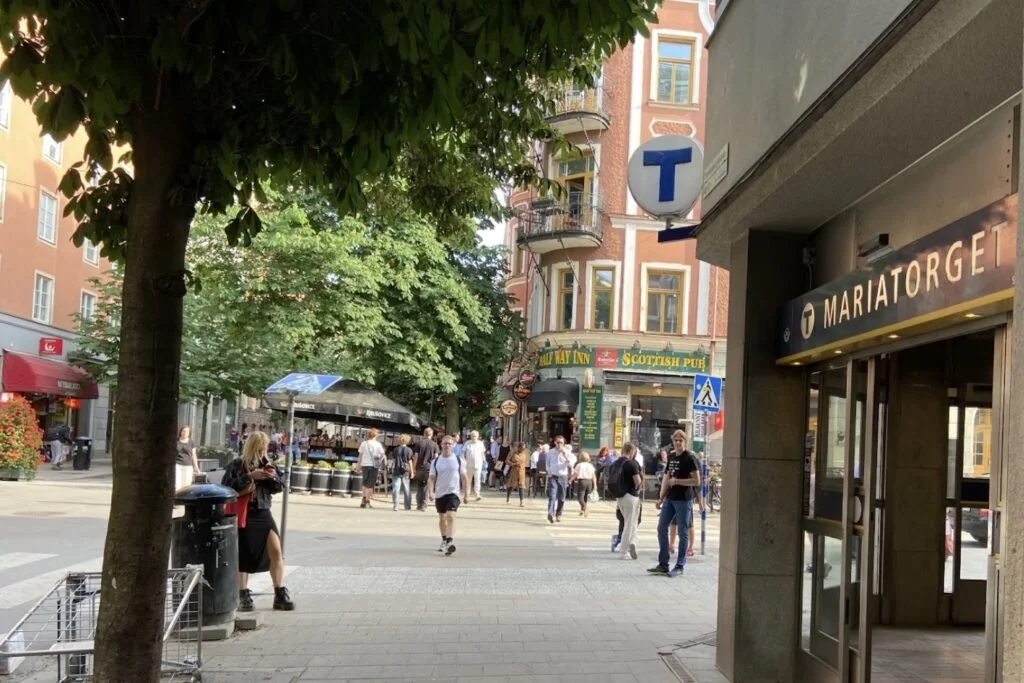
Compare Ørestad to a random street in the old city of Copenhagen—and I do mean random: I picked a street near a Metro station on Google Maps and this is what I got. Here, the streetlife keeps going and going.

Frederiksberggade, Copenhagen, part of the city’s large pedestrian area, Strøget. (Google Street View)
A few years ago, a researcher named Todor Stojanovski got fed up because places like Ørestad are far too common. Planners and architects follow all the latest best practices to create new, healthy, vibrant communities, but instead, they end up with empty, lifeless streets.
So Stojanovski decided to go out and see first hand exactly which streets attract life—like Swedenborgsgatan in Stockholm, pictured below—and which do not. What he found offers a valuable lesson for designing vibrant communities. Crucially, you have to pay attention to the limitations of the human eye.
Swedenborgsgatan, Stockholm. (Todor Stojanovski)
400 metres versus reality
Stojanovski wondered whether a simple 400-metre circle really captured what mattered. Yes, people can walk to any destination in that circle quickly. But will they?
When he mapped out streetlife, what he found was not a circle, but a blob. Streets are most vibrant directly next to transit stations, and this vibrancy bulges outwards on some nearby streets. And these blobs are nowhere near 400 metres. The majority of streetlife happens within 100 metres of stations.

A map of where you find both street life and shops in Hotorget (left) and Skanstull (right), Stockholm. (Diagram by Todor Stojanovski, with adjustments to the legend and symbols by Tristan Cleveland)
Stojanovski proposes a simple explanation: 100 metres is about the distance people can see clearly. What matters most for supporting commercial space isn’t what people can theoretically walk to, but what they can see.
And even 100 metres is a bit far. According to Jan Gehl, people can only make out facial expressions at about 25 metres. This is also roughly the distance where they can make out what is happening inside shop windows. People can only hear a vendor clearly at about 30 metres, and have a conversation with someone at about seven metres. Gehl calls all this the “social field of view.” This is the scale that matters most for creating successful streets.
A Korean study found a similar (unsurprising) result: Businesses earn more when lots of pedestrians can see them. Another study, by James Fenske—one of Stojanovski’s students—mapped the locations of ground-floor retail and informal vendors near transit stations in Dar es Salaam, Tanzania. Businesses congregate tightly around the routes transit riders walk. In the diagram below, every informal business is located within roughly 25 metres of one of the primary walking routes.

Diagram from Retrofitting Accessibility in a Rapidly Expanding City by James Fenske, showing that ground-level retail and informal vendors congregate around the walking routes to and from transit.
Four hundred metres remains the right scale for some things: People will find their way to their homes and office jobs without needing to see them from the transit station. But to create vibrant streets and public spaces, and to support street-level businesses, designers have to focus on the human eye.
Three lessons for creating vibrant streets
We can draw three practical lessons from these studies.
First, if you want to create a vibrant, transit-oriented development, you need to ask exactly what people will see when entering and exiting transit. Then, you need to make sure it is full of places to sit, talk, eat, and shop. Those first 100 metres—and especially the first 25 metres—are your principal opportunity. Screw this up and the streets will whither.
Take Ørestad. Many of the buildings visible from its transit stations have few entrances or retail spaces. Equally, there are no high-quality public spaces within view. These amenities exist, but they’re in the wrong places. The streets therefore act like a funnel to carry people away, rather than as a place to stop and spend time.
Second, if you already have a transit station, and it has too little streetlife, focus on fixing the problem within that first 100 metres. Consider creating kiosks, places to sit, games, or other reasons to be there. Invite food trucks. Do whatever is necessary to make the most of that tiny area people can see.
Third, if you have some streetlife, and want more of it, focus on the next 100 metres. If people spend time on one section of street, the next logical place to open a business is within eyesight of those people. And if people walk to those new businesses, this pushes streetlife a bit further, allowing even more businesses to open.
Streetlife is like an organism that slowly grows outwards, as businesses and streetlife reinforce each other’s success.

A map of street life and shops in Drottninggatan, Norrkoping. Here, streetlife extends beyond 100 metres to nearby businesses along each street. In turn, this allows more businesses to open, extending streetlife even further. (Diagram by Todor Stojanovski, with adjustments by Tristan Cleveland)
A case study: Helping vibrancy grow
We recently wrote about how Surrey, B.C. sought to create streetlife and catalyze development near a SkyTrain station. Before it could transform the entire area, the City had to first invest in "One Great Block"—at least one place with enough new, pedestrian-oriented development to support both streetlife and retail. Wisely, Surrey focused on what people could see from the transit station. The City built a new library, plaza, and mixed-use building, all within 100 metres of the station. In doing so, it convinced developers that pedestrian-friendly buildings could succeed there.
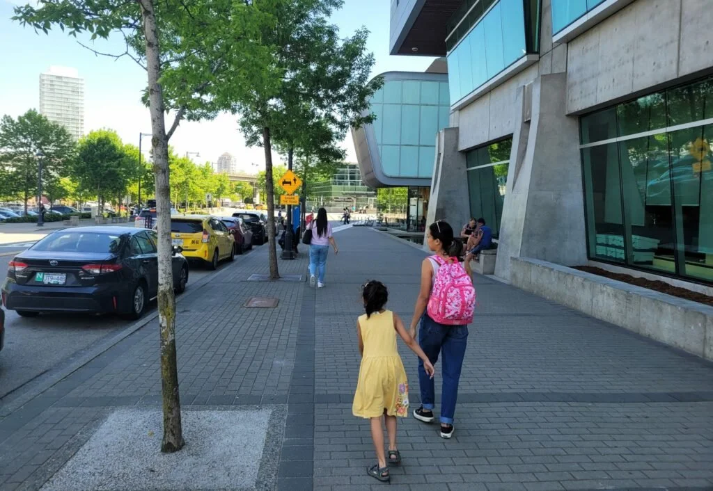
People on the street, a short walk from the Surrey Central Station and City Hall, next to a university campus. (Tristan Cleveland)
The next challenge Surrey faces is to grow this streetlife outwards, by encouraging more pedestrian-friendly development in the places near to where people already walk.

A parking lot between two transit stations in Surrey. King George Station, and its towers, are in the background. (Tristan Cleveland)
Here are a few strategies for growing streetlife, focused on what people can see:
Targeted placemaking. Are there underused parking lots, streets, or public spaces next to the areas where people already walk? What low-cost interventions will draw people to walk just a little farther? Public art, games, garden boxes, umbrellas, and paint can do the trick.
Temporary commercial space. Kiosks, food trucks, and beer gardens add local businesses within eyesight of existing streetlife, without needing to wait for new development. And once you extend that streetlife a bit further, it gives developers more reason to build.
Renovations. Are there blank walls or dead, unusable spaces that discourage people from walking any further down the street? Consider making targeted investments to open walls and add new retail for the buildings visible from existing streetlife. Or, mitigate the damage with trees, flowers, murals, and places to sit.
Detailed building design. Buildings next to existing streetlife should be held to a higher standard: City staff should ensure these buildings do everything possible to invite people to spend time on a street and walk a bit farther. It matters more here than anywhere else.
Pedestrian-priority design. Wide roads can block streetlife from growing. If roads are loud, fast, wide, or dangerous at the edges of streetlife, experiment with interventions to slow traffic and make streets more pleasant to walk on.
These strategies require a consistent, disciplined focus on the few streets that are visible from transit stations and existing streetlife. This does not come naturally to planners: We usually like to set policy for large areas. But to cultivate vibrancy, we need a new kind of focus. We need to first zero in on just a few dozen metres, and ask whether we are doing everything in that tiny area to help it thrive.
And it’s worth the effort. It is these vibrant streets that tourists want to visit, that attract young employees, and that give people reason to live in a city. If we consistently cultivate that vibrancy outwards, we can, over time, transform an entire community into a vibrant, wonderful place. But to make it happen, we need to pay attention to what people can actually see.